LOOKBACK: Vital bridge over Cedar River had three lives
1867 structure over downtown Austin dam relocated in 1901, 1917 around city

By Tim Ruzek, CRWD outreach coordinator
Downtown Austin has seen soldiers, decorative floats, marching bands and even circus animals parade through its streets but nothing like what was witnessed in 1901.
Austin’s old Water Street bridge (4th Ave NE) was removed from its perch above the Cedar River’s flour-mill dam after serving since 1867 as the main crossing to the eastside railyard and depot.
Spanning 100 feet and weighing 40 tons, the iron bridge was hauled west on rollers to North Main Street and then south to become the roadway’s first bridge over the Cedar.


Navigating the left turn onto Main proved tricky as the bridge “was turned with considerable difficulty, there being just room enough for the long structure to clear the buildings,” the Mower County Transcript wrote Oct. 30, 1901.
“It must have been a strange sight for local residents to watch the bridge inching its snail-like way through the business street,” Austin Daily Herald columnist “Old Timer” wrote in 1950.

This three-day move attracted “considerable attention and also makes considerable trouble for some of our people on this side (west) of the river,” the Herald wrote in 1901.
Austin’s old bridge was vital for the young community officially organized as a village a year after its installation.
In spring 1867, Water Street’s road and bridge needed repair. The first railroad to Austin was being built.


“All travel to the railroad depot will be at this crossing, and it is proper that the bridge and roads leading to it should be put in good condition soon,” the Mower County Register wrote April 4, 1867.
Two months later — before a dam was built later that fall — flooding carried away the small crossing over the river — “not a single timber remains to tell the story of its past,” the Register wrote. At the time, the river’s east side only had a few homes.


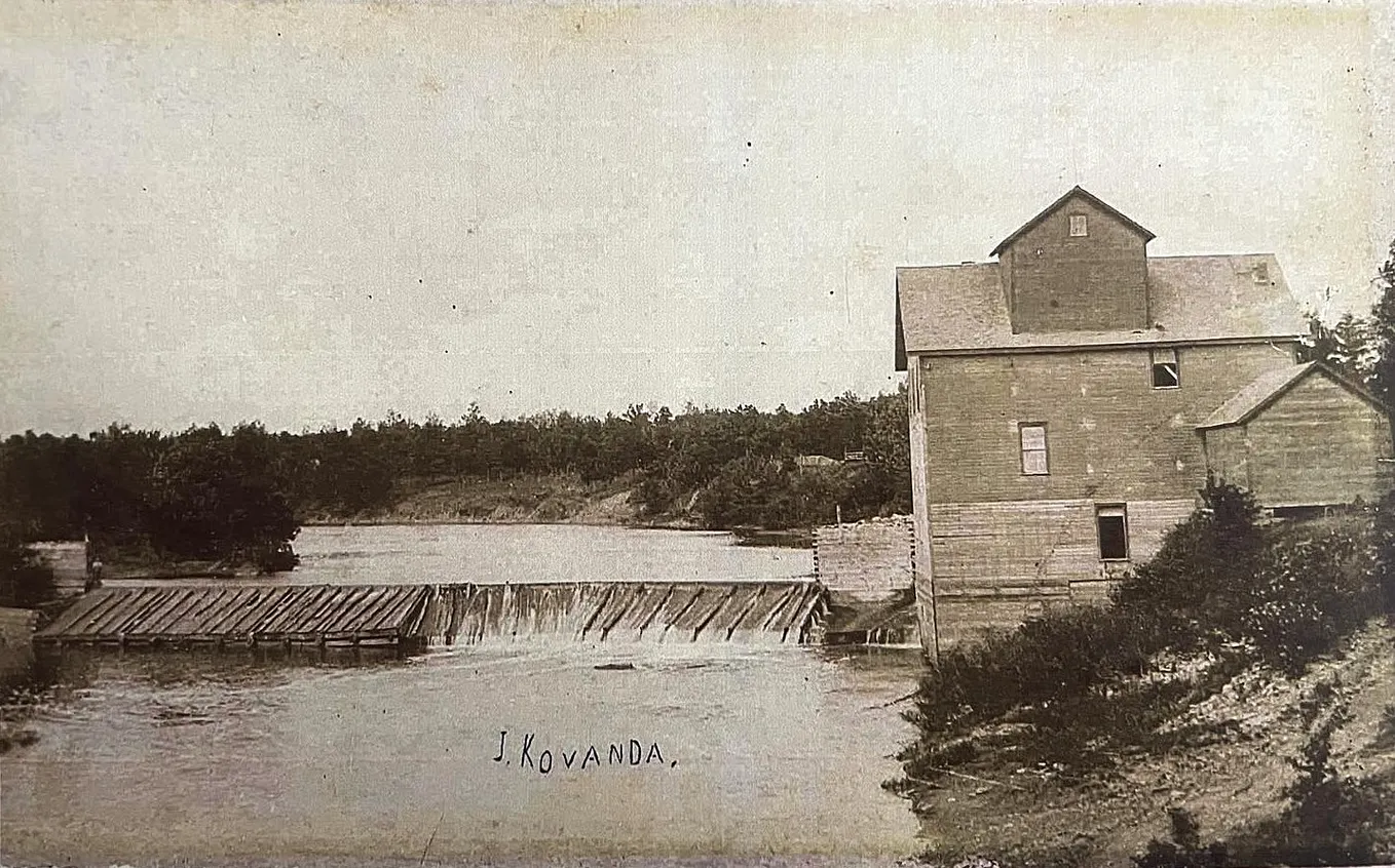
That included the home of Simon Alderson, who was building a dam and flour mill at Water Street. He opened for business in early 1868.
With the railroad coming to Austin, Mower County commissioners voted that summer to build a larger bridge in line with the new depot.
On Oct. 14, 1867, crews laid the last rail between Austin and LeRoy. Three days later, train cars carrying Minneapolis flour passed through headed for Milwaukee.
A month later, Water Street’s bridge opened as the first passenger trains came to Austin.
Get Cedar River Watershed District’s stories in your inbox
Join Medium for free to get updates from this writer.
In 1870, the Bridge Street bridge (2nd Ave NE) was added over the Cedar.


By 1895, citizens wanted a South Main bridge over the Cedar to go with River Street’s bridge (4th St SE).
Six years later, the county approved moving the old bridge to South Main and building a new Water Street bridge to accommodate increasing east-west traffic.
Installed a month after its move through downtown, the old bridge opened a previously “out-of-the-way corner away from easy connections with the city,” the Transcript wrote.
At the same time, this wooded, 12-acre area on both sides of South Main became Austin’s second park, Lafayette.
Water Street’s new bridge opened in early 1902 and was replaced in 1924 when the dam was extended for the city and Hormel flour mill.


Locals couldn’t believe that bridge only was worth selling as scrap metal. Apparently, higher-quality iron was used for the old bridge, which, at that time, was serving the city at a third location over Dobbins Creek near today’s Queen of Angels Church.


In early 1917, voters approved bonds to address 100-plus bridges countywide, including the old bridge at South Main.
That spring, the county and city agreed to replace South Main’s bridge. The city paid extra for the design given plans in 1918 to celebrate Austin’s 50th anniversary of being a village.
“The council decided that Austin wanted a fine-looking bridge as it is on the line of travel for autos from St. Louis to St. Paul and will be traveled by thousands of tourists each year,” the Herald wrote.

A month later, floodwaters destroyed a dozen bridges around Austin, including South Railway Street (10th St SE) over Dobbins.
This created an opportunity to reuse the old bridge at Railway Street.
“What is probably the most-traveled 100-foot bridge in the state is now close to its new position on South Railway Street,” the Herald wrote.
George Detwiler, who moved the bridge in 1901, “hitched his tackle to it and hauled it nearly two miles to the place where the Dobbin had torn out a structure.”

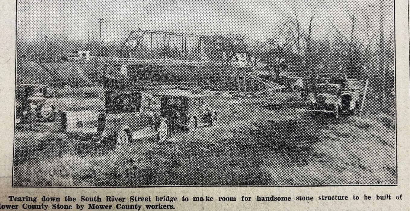
In 1935, the city voted to remove the old bridge and not replace it at Railway Street under a project converging Minnesota Highway 16 and U.S. 218 into Austin on a new, four-lane roadway (Oakland Avenue East).
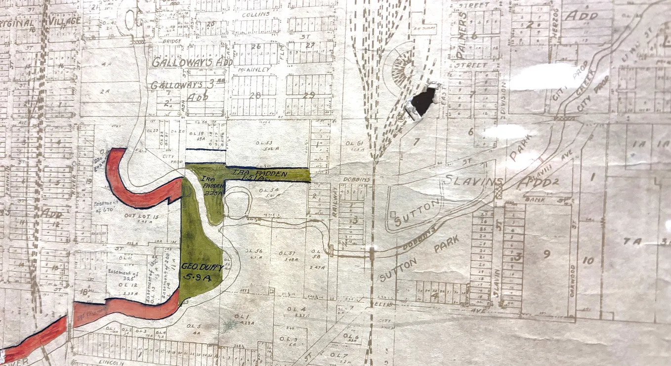
This created today’s 10th Dr SE bridge over Dobbins and rechanneled the creek toward the Cedar to reduce the new highway’s flood risk.
While unclear, the old bridge likely was removed in 1937. Its last news reference was with the March 1937 flooding.
While the old bridge didn’t get a good farewell, the Herald heaped praise in 1901 for its years of being “trodden upon, ridden over and, in other ways, trampled under foot.”
This bridge watched many seasons and people come and go while providing much good despite no one showing gratitude, the Herald wrote.
“Youth and old age, joy and pain, business traffic and toil have crossed this bridge for many years. (If the bridge) could speak, it would tell stories that would entertain the town for a year.”