Exploring Public Transit Options with Google Maps: A Commuter’s Guide


Let me tell you a story. A couple of years ago, I was visiting a new city, totally unfamiliar with its public transit system.
I wanted to get to a famous museum, but I had no clue which bus or train to take. That’s when Google Maps came to my rescue, making my journey smooth and stress-free.
Now, I use Google Maps not just when traveling but also in my daily life. If you’ve ever felt overwhelmed by figuring out buses, trains, or subway systems, this guide is for you.
Let’s dive into how Google Maps can make navigating public transit super easy, even if it’s your first time.
Step 1: Setting Your Destination
First things first — open Google Maps and type in where you want to go.
For example, when I was in Kuala Lumpur, I wanted to visit the Petronas Towers. I typed it in, and voilà! The map showed me exactly where they were.
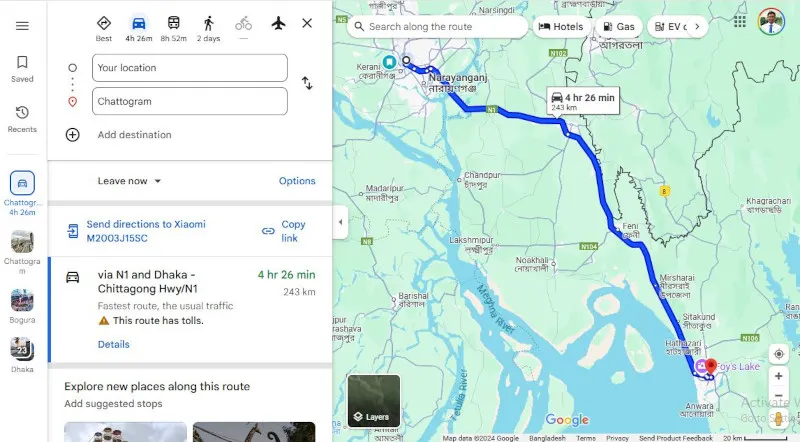
Now here’s the trick: Tap on the “Directions” button. This will bring up different options for getting there — driving, walking, biking, and yes, public transit!
Step 2: Choosing the Public Transit Option
Once you see the different options, select the little train or bus icon. This tells Google Maps you want to use public transportation.
Here’s what I love — Google Maps doesn’t just give you one route. It shows multiple options with estimated travel times.
For instance, when I wanted to get to a market in Malaysia, it suggested a bus, a metro rail, and even a combination of both.
It even told me how long each option would take, so I could pick the fastest one.
Step 3: Understanding Your Route
Now, this part is super cool. Google Maps breaks down the entire journey step by step:
- Which bus or train to take
- Where to get on and off
- If you need to switch to another route
Once, in Hanoi, Vietnam, I had to take a bus and then switch to a different one to reach a café.
Get Kamruzzaman Nayan’s stories in your inbox
Join Medium for free to get updates from this writer.
Google Maps showed me the exact bus numbers and where to transfer. I didn’t even have to ask anyone for directions — it was all there on my screen.
Step 4: Live Updates
Have you ever waited for a bus, wondering when it will actually show up?
Google Maps has a feature that shows live transit updates for many cities. It tells you if your bus or train is delayed and even shows its current location.
When I was visiting Malaysia, I used this feature to time my walk to the bus stop. No more waiting around in the heat!
Step 5: Using Offline Maps
Here’s a pro tip I learned the hard way: download an offline map if you’re traveling to a new place.
Once, my phone ran out of data in a small town, but thankfully, I had already downloaded the map of the area.
Even without the internet, I could check my route and get to my destination.
Why Google Maps Makes Transit Easier
Google Maps isn’t just about showing routes; it’s about making your life easier. Here’s why I keep coming back to it:
- It saves time by giving multiple options.
- It reduces stress — you know exactly where to go.
- It’s reliable, especially with live updates.
I remember feeling nervous the first time I used public transit in a foreign country. But with Google Maps, I felt like I had a local guide right in my pocket.
Tips for First-Time Users
- Double-check the schedule: Sometimes, buses or trains don’t run as frequently as shown.
- Keep an eye on landmarks: It’s helpful to know what the area around your stop looks like.
- Plan ahead: If you’re not in a rush, explore the alternate routes suggested by Google Maps.
Your Turn to Explore
Public transit doesn’t have to be intimidating. With Google Maps, you can confidently explore new cities or navigate your daily commute.
So, next time you’re planning a trip — or just trying to get to your friend’s house — give public transit a try using Google Maps.
You might even discover a quicker route or enjoy the scenery along the way!
Let me know about your experience in the comments. I’d love to hear how Google Maps has helped you in your journeys!